Africa Climate Security Risk Assessment Infographics
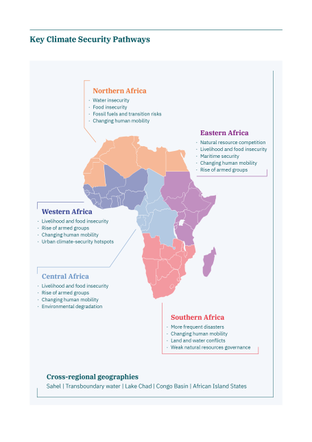
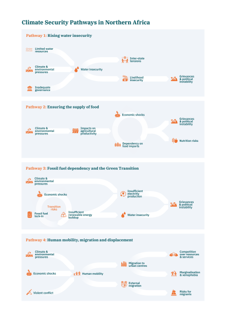
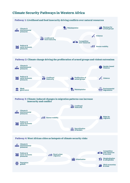
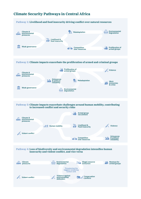
The Africa Climate Security Risk Assessment (ACRA) offers a comparative analysis of climate security risks in Northern Africa, Western Africa, Central Africa, Eastern Africa and Southern Africa. Additionally, it also focusses on transregional geographies, in particular African island states, the Congo and Lake Chad Basin, transboundary waters and the Sahel. The infographics in this assessment provide an overview of these regional climate security risks as well as climate security pathways in each region. They can be downloaded below.
- Northern Africa
The Climate Security Pathways in Northern Africa infographic can be downloaded here.
- Western Africa
The Climate Security Pathways in Western Africa infographic can be downloaded here.
- Central Africa
The Climate Security Pathways in Central Africa infographic can be downloaded here.
- Eastern Africa
The Climate Security Pathways in Eastern Africa infographic can be downloaded here.

- Southern Africa
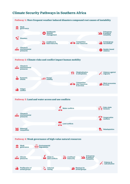
The Climate Security Pathways in Southern Africa infographic can be downloaded here.
Kindly note that you may reproduce and share infographics as follows: ©adelphi

Weathering Risk Team
If you are interested in a specific regional pathway infographic as a separate file or have any questions about the infographics and copyright, please reach out to our team at weatheringrisk@adelphi.de
Share on

